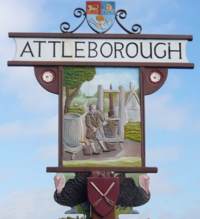
Attleborough town in Norfolk, England, UK.
The original foundation appears to have been lost in the mists of time, but the most popular theory of the towns origin leads us to believe that it was founded by Atlinge, King of the province, and certainly burgh (or burh) indicates that it was fortified at an early date.
After the Danes swept across Norfolk and seized Thetford, it is believed that the Saxons rallied their forces at Attleborough and probably threw up some form of protection. Although the Saxons put up a vigorous resistance, they eventually capitulated to the Danes and during the time of Edward the Confessor, powerful Danish Families like Toradre and Turkill rules local manors. If local records are correct, nothing but disaster was brought to Attleborough by the Danes, and it took the coming of William the Conqueror to restore some sense of well-being to the area.
Turkill relinquished his hold on the area to the Mortimer family towards the end of Williams reign, and they governed Attleborough for more than three centuries. In the 14th Century the Mortimer family founded the Chapel of the Holy Cross (being the South Transept of Attleborough Church), about a century later, a Sir Robert de Mortimer founded the College of the Holy Cross, and later was added the Nave and Aisles, to accommodate the congregation.
Following Henry the VIIIs dissolution of the monasteries the building was virtually destroyed by Robert Radcliffe, Lord Fitz Walter, Earl of Sussex, and material from the building was used for making up the road between Attleborough and Buckenham. However this left Attleborough Church with a tower at the East End.
Many towns can claim the distinction of having had a fire, and Attleborough is no exception, a great part of the town being destroyed by fire in 1559. It was during that period that the Griffin Hotel was built, and it was in the cellars of the Griffin that prisoners on their way to the March Assizes in Thetford were confined overnight, tethered by chains to rings in the wall.
The arrival of the prisoners aroused a great deal of public interest, and eventually traders set up a fair whenever they came. This became known as Attleborough Rogues Fair and was held on the Market Place on the last Thursday in March. Also on the market place festivities took place on Midsummer Day, when the annual guild was held. It appears that there has been the right to hold a weekly Thursday Market in the town since 1285. A weekly market is still held in Queens Square on a Thursday.
The first turnpike road in England is reputed to have been created here at the end of the 17th Century, Acts of Parliament were passed in 1696 and 1709, "For the repairing of the highway between Wymondham and Attleborough, in the County of Norfolk, and for including therein the road from Wymondham to Hethersett" Another theory is that Atlinge was in fact Athla, who according to Galfridus de Fontibus was the founder of the Ancient and royal town of Attleborough in Norfolk. In the Doomsday survey launched in 1085 it is referred to as Attleburc.
The first national census of 1801 listed the population of Attleborough as 1,333. By 1845 Attleborough certainly dominated the surrounding parishes with a population of nearly 2000, and in that year the railway (Norwich to Brandon) arrived.
The town supported six hostelries, The Griffin-the oldest-, The Angel, The Bear, The Cock, The Crown and The White Horse. The Griffin, The Bear and The Cock still operate but The Crown is now a Youth Centre and The Angel is a building society branch office. Nothing is known of the fate of The White Horse. There are currently two more public houses, The London Tavern and The Royal Hotel.At the centre of the town is Queens Square,at one time referred to as market hill.
In 1863 a corn exchange was built in the High Street owned by a company of local farmers and in 1896 the Gaymers cider-making plant was built on the south side of the railway and soon became established as the largest employer in the town. Sadly the factory has now closed for cider-making, but has recently re-opened as a chicken processing plant, and the corn exchange is now a warehouse for a firm of electrical retailers.The first world war affected Attleborough probably for no better or worse than many similar small towns. Five hundred and fifty men joined the armed forces and ninety six did not return.
The 1920s saw continuing growth as a market centre, held on a Thursday the
stalls spread along the pavements of Church Street and in an open area by the
Angel Hotel opposite the Griffin Inn. It was the turkey sales which made the
town a thriving market centre in the 1930s, and thousands were sold each year on
Michaelmas day. Local employment still largely revolved round Gaymers cider
works.
In the early thirties the Corn Hall was sold and became a cinema, reaching its
heyday in the early 40s.Following the Wall Street crash in October 1929 it was
some months before its effect was felt on the rural domestic economy but when it
came the experience was to make itself felt indelibly on those who went through
it.
For those out of work the situation was serious, The system of means testing meant that the father or mother had to go before a tribunal to plead poverty, both slow and degrading, yet this was the only way to get any sort of financial help. A father of six children could expect to receive30/-(£1.50) for his family for one week, if he was lucky.Well into the 1930s lighting was by oil lamps, then came the building of the Gas Works in Queens Road (since demolished, although the Gas Keepers house is still there). Gradually gas was piped into homes, but it was a slow process.
During 1939 the Old Post Office was sold and it became the Doric Restaurant in Queens Square. It is now the Town Hall. The new Post Office was built in Exchange Street. Much has been written about the 1939/45 war elsewhere, and again it affected Attleborough no more or no less than many other small towns in East Anglia. There were two local airfields, one at Deopham Green (Station 142) and one at Old Buckenham (Station 144).
Structurally the town changed little during the 1950s and there were no great leaps in population growth. The sixties were different, the overspill programme and new town development brought new families into south Norfolk. Attleborough had to make decisions for the future and new development zones were designated.
The first estate programme began with the building of the council-owned Cyprus Estate which has since been complemented by other private housing schemes such as Fairfields and Ollands built mainly in the 1970s and a large estate on the south side of the town in the 1990s.The traditional traffic route along the A11 trunk road became a bottleneck as it ran both ways along High Street and Church Street, thus in the 1970s a one-way system was opened channelling traffic around the natural ring road surrounding the church. The volume of traffic continued to increase making that change obsolete so the Attleborough bypass was opened in 1984.
There are two schools in the town, Attleborough High School on the Norwich Road and the Middle School on the Besthorpe Road.
Information Wanted
If you have any information to add or a web site to link to please email us the details and we will update this page. Thank you.